How soaked is Southern California? The astonishing rainfall totals

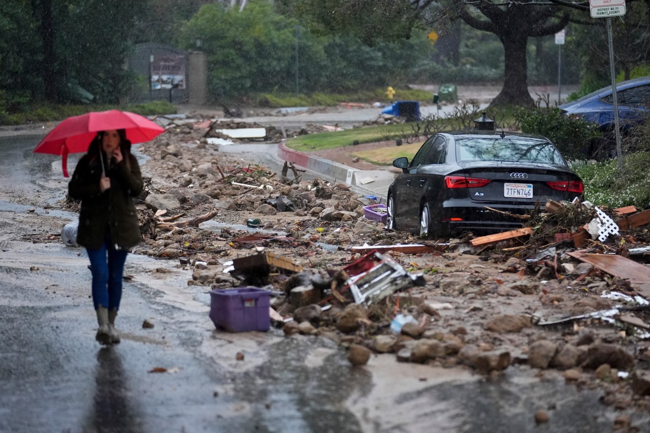
Record-breaking rainfall has drenched Southern California over the past four days, leaving the entire region soaked and causing extensive property damage.
According to National Weather Service reports, some of the highest rain totals in the entire region were in Los Angeles County.
Downtown Los Angeles saw the most rain over a two-day period since 1956, NWS said, adding that nearly half of the average seasonal rainfall for Los Angeles fell on Sunday and Monday alone.
Rainfall totals for Southern California communities can be found below:
Los Angeles County
- Cogswell Dam (13.86 inches)
- Topanga Canyon (13.48 inches)
- Bel Air (13.04 inches)
- Sepulveda Canyon at Mulholland Drive (13.02 inches)
- Woodland Hills (12.62 inches)
- Stunt Ranch (12.56 inches)
- West Fork Heliport (12.25 inches)
- Opids Camp (11.85 inches)
- San Gabriel Dam (10.94 inches)
- Porter Ranch (10.64 inches)
- Santa Anita Dam (10.47 inches)
- Mt. Baldy (10.26 inches)
- Monte Nido (9.76 inches)
- Lechuza Beach (9.73 inches)
- Agoura Hills (9.40 inches)
- Beverly Hills (9.35 inches)
- Big Dalton Dam (9.29 inches)
- Morris Dam (9.22 inches)
- Santa Fe Dam (9.20 inches)
Significant rainfall also fell in the San Gabriel Valley, where communities such as Alhambra, La Verne, Pasadena, Sierra Madre, and Claremont all received more than eight inches of precipitation during the atmospheric river event.
Other Los Angeles County communities that saw significant rainfall include downtown L.A. (8.66 inches); Calabasas (8.39 inches) and Culver City (8.32 inches).
Ventura County
- Matilija Canyon (9.37 inches)
- Old Man Mountain (9.33 inches)
- Rocky Peak (9.02 inches)
- Ortega Hill (8.13 inches)
- Sulphur Mountain (8.12 inches)
- Lake Piru (7.80 inches)
- Rose Valley (7.76 inches)
- South Mountain (7.66 inches)
- Thousand Oaks (7.65 inches)
- Nordhoff Ridge (7.64 inches)
- Westlake Village (7.61 inches)
- Harmon Canyon (7.38 inches)
Ventura County coastal communities, such as Saticoy, Ventura and Oxnard, saw five inches or less, according to NWS.
Orange County
- Santiago Peak (9.96 inches)
- Horsethief Canyon (8.66 inches)
- Leach Canyon (8.58 inches)
- Coto de Caza (7.40 inches)
- Upper Harding Canyon (7.24 inches)
- Orange County Reservoir (7.15 inches)
- Brea (6.26 inches)
- Moulton Peak (6.14 inches)
- Lower Oso Creek (5.78 inches)
- Garden Grove (5.44 inches)
- Bell Canyon (5.30 inches)
- San Juan Capistrano (5.28 inches)
- Laguna Niguel Park (5.24 inches)
- Carbon Canyon Dam (5.23 inches)
- Fullerton Dam (5.03 inches)
- Villa Park Dam (4.80 inches)
- Yorba Reservoir (4.73 inches)
- Lower Silverado Canyon (4.57 inches)
- Huntington Beach (4.49 inches)
San Bernardino County
- Middle Fork Lytle Creek (13.99 inches)
- Deer Creek Dam (11.18 inches)
- Bernina Drive (10.73 inches)
- Panorama Point (10.32 inches)
- Glen Helen Regional Park (10.12 inches)
- Cucamonga Canyon (9.92 inches)
- Devore Fire Station (9.15 inches)
- San Sevaine Peak (9.09 inches)
- Cal State San Bernardino (8.39 inches)
- Little Chino Creek (8.23 inches)
- San Antonio Heights (7.79 inches)
- Rialto (7.52 inches)
- Mormon Rocks (6.25 inches)
- Elder Creek (6.41 inches)
- Ontario Airport (6.14 inches)
Riverside County
- Pioneertown (4.95 inches)
- Beaumont (3.84 inches)
- Poppet Flat (3.81 inches)
- Banning (3.70 inches)
- Vista Grande (3.68 inches)
- Antelope Creek (3.18 inches)
- Dutch Flat (3.13 inches)
- Allandale (2.87 inches)
- Upper Tahquitz Creek (2.56 inches)
Despite a break in the rain on Wednesday, it’s not over just yet for Southern California. According to weather officials, more showers are forecast to move into the area Wednesday night.


